Entry/exit of Valle de Constellationes | Tourist Attraction
Colombia
Details
- Verified:
- 10 days ago
- GPS:
- 3.26086, -75.20465
- Altitude:
- 2916.0 masl
- Contributor:
-
 Tucks' Truck

Amenities
Something not right?
Description
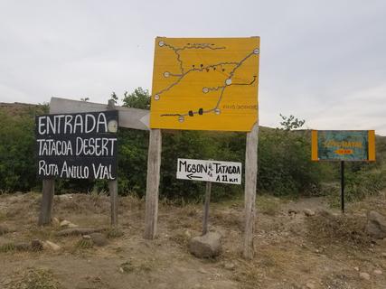
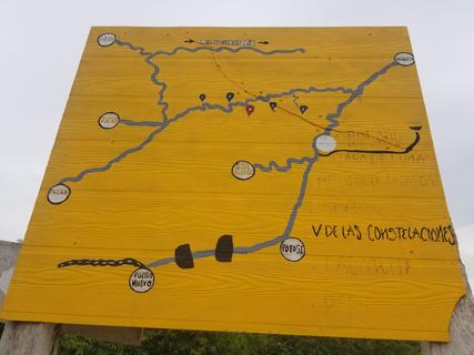
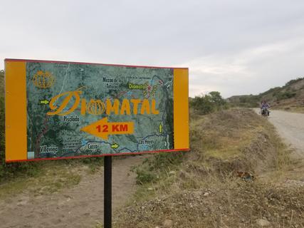
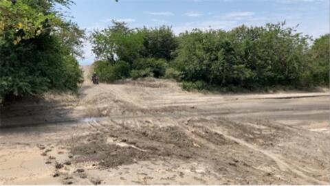
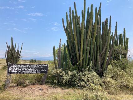
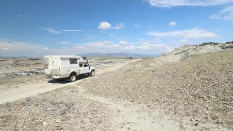
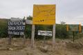
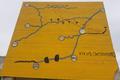
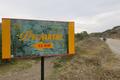
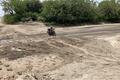
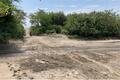
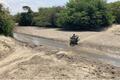
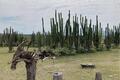
This route isn't on open source mapping (yet - Sept '17. 22' update: only the first km available), but it's far nicer than the well-driven Tatacoa route just to the south. This is the access route to the Valle de Constellationes camp site, but all along here are some amazing wild camp spots. there are a couple of gates to open, but at each one there is a tourist information sign. You can continue down this track to do a loop onto the main Tatacoa road. Go past the two lodge/campsites to the T-junction at the end, turn right, and it comes out at the eastern end of the Tatacoa desert. We saw one local sedan-car doing this route, but ideally you'd want high clearance. It’s a bit rough in parts, but very beautiful. Well worth the effort for amazing wild camping.
Photos
Why? By checking in after you’ve visited a place you let others know this place is still functional. You can also add or correct any information.
Latest Check-Ins
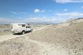
Drove this today in an AWD Ford Transit van. Not high clearance, but not super low clearance either.
Totally fine, but there are some deep rutted sections where you need to pick your line carefully. Dry conditions. Rainy might have been another story. Really beautiful “backroad” of sorts in this area. Nice and quiet and off the beaten path.
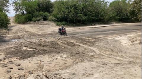
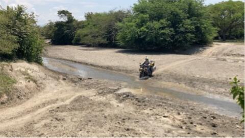
Report Check-InThis track in the gray desert is incredible! It is wild and far from tourism on the southern track. There are a lot of possibilities to bivouac. To come here you need a high clearance vehicle and if the weather is rainy a 4x4 is recommended.
Report Check-InNot sure if you want to take this road, coming from north?
For a relaxed visit with your own vehicle:
- Take the rural road from Neiva to Villavieja (all paved, except few gravel patches and potholes; the usual).
- In Villavieja take the "Tatacoa" road; it is paved until the red desert.
- Follow the road from red desert to grey desert (Los Hoyos); it is gravel, but very smooth and well maintained
We enter the loop here with our Opel Movano 2x4 van and had no problems at all the drive over the dirt road. We can imagine with wet conditions it is challenging but for us it was slow but easy.
Report Check-InWe entered the loop drive here. Road was ok, but would want high clearance. Had to trim some trees along the route to fit our 3.3m high truck camper. We drove slow, and spent a few nights along the way. Very different then the rest of Colombia, it's very quiet here :). Roads were all fine, but rough in places from washouts.
Report Check-Inthe first km of this road is on Google maps but just ends. it keeps going. we did it in our van without engaging 4x4 but high clearance required in a few spots when approaching or exiting river crossings, even if dry. the worst spot I think was at the creek right before the grassy field pin. if you can make it past that then the rest is doable.
Report Check-InGood way into the park if coming from the north but, right now it’s definitely a high clearance 4x4 road ever though it hasn’t rained much lately. A few sections are pretty rutted out and 1 river crossing would be challenging / impossible in 2x4 (hardly any water but muddy)
ADV bike heaven and 4x4 guys that like a more adventurous road might enjoy this one, we sure did!
We used this as our exit from the Constellation loop. The loop was great with no shortage of wild camp spots.
This entrance is 5 km from town on a rocky road, in some ways it was worse than the Constellation track.
Report Check-Invery nice drive. doable on any vehicle when dry. nice campsites all over the valley. the red desert and all that is quite touristy.
Report Check-InThis street is already in Openstreetsmap, this is the source of Maps.me but maps.me doesn't show this. We use Navit and this show this street with more another streets.
Report Check-InA beautiful and lonely road. In dry the road is easy driving without 4x4, wet probably 4x4 get stuck too.
Report Check-Inthis route isn't on open source mapping (yet - Sept '17), but it's far nicer than the well-driven Tatacoa route just to the south. this is the access route to the Valle de Constellationes camp site, but all along here are some amazing wildcamp spots. there are a couple of gates to open, but at each one there is a tourist information sign. You can continue down this track to do a loop onto the main Tatacoa road. Go past the two lodge/campsites to the T-junction at the end, turn right, and it comes out at the eastern end of the Tatacoa desert. We saw one local sedan-car doing this route, but ideally you'd want high clearance. It’s a bit rough in parts, but very beautiful. Well worth the effort for amazing wildcamping.
Report Check-In