Check-Ins
| When? | Who? | Comment | Place | Location |
|---|---|---|---|---|
|
drousseau
|
Public Wifi code is currently written on the tourism office door. |
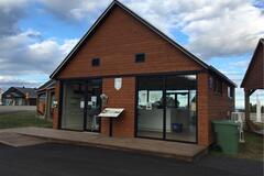
Wifi Halte Routière Saint-Siméon | 47.83781, -69.88168 | |
|
||||
|
plarose17
|
EVERY municipality should have spot like this allocated for overnights. Thank you town of Exeter. Very nice and appreciated. |
Elliott Park | 43.35665, -81.48361 | |
|
cyndrew33
|
Super buggy!!! No one here for
|
Freezeout Lake | 47.68335, -112.04499 | |
|
julieo81
|
If following Google do not turn off of the first dirt road until you see the sign for the park and the building. Google said to turn too early |
Casa Caravan BCS | 23.34423, -110.16675 | |
|
@k8tskya
|
Free dump station. Went in to ask and make sure. It’s back behind diesel. |
Sapp Bros | 40.69095, -95.78935 | |
|
MotorPilgrim
|
Rest stop and picnic area with 3 tables and pit toilets... There are "No Overnight Camping" signs posted. It'a beautiful here... |
South Last Mountain Lake | 50.74650, -104.86740 | |
|
vinzmich
|
As described. Beautiful sandy beach. The lot is just where the road ends. The bridge over the river is in construction. We will see tomorrow morning how soon workers get to work! |
Mira Gut Beach | 46.03676, -59.96730 | |
|
drousseau
|
So far so good, just arrived. Spot is super quiet by the road and the grass is even cut. |
Chemin Saint-Thomas Nord | 48.23318, -70.21997 | |
|
jenniferdo.jdo
|
We stayed for one night. Big parking lot at a park with no signs about over night parking. Huge field for the dogs to run and right next to a river! In the morning lots of locals using the park to exercise. Bathrooms are clean. AT&T and Verizon had service but really slow... t mobile had service at 8 download and 2 upload. We are in a camper van - anything over 22 feet would be an issue... it is a neighborhood park - so incognito is best ! |
Sequoyah Park | 35.92892, -83.97407 | |
|
Frankazoid Travel
|
just small place with local trail to the village below. no too leveled, no cell signal, some locals walking by during the day. didn't stay for a night though. not visible from the road |
Xilitla Mountains | 21.34039, -98.97565 | |
|
||||
|
kimverplancke
|
Fantastic facility and free. Right off the road where pinpointed, quick and easy. FREE |
Dixie National Forest dump and water | 37.70443, -112.64962 | |
|
brookewebster.14
|
TO CLEAR THE AIR.
|
Borden Bridge Campground | 52.37651, -107.14462 | |
|
transformative2020
|
Found it easily and didn't have any issues. Very clean! |
Annacortes water treatment center | 48.51889, -122.60732 | |
|
transformative2020
|
We passed on it. It's $20 to dump and you have to go to the office and pay another $20 for the key to access it, which you get back upon returning the key. We dumped at Anacortes instead for free. |
Friday Harbor Wastewater Treatment Plant | 48.53817, -123.02338 | |
|
hi
|
Propane, gas, water and dump! Friendly staff. And portopotties if you come after hours |
Chevron Gas Station | 39.32264, -120.22763 | |
|
celja.and.nathan
|
Came on Labor Day Monday night and the crowds had gone. Got a nice, deeply shaded and level spot to park the van. Great views of the puget at the nearby park. Hot showers, 25¢ for 3 min. Only reason for the docked star was the price – too expensive for how close together/crowded the sites were, but because the camp wasn’t full it felt ok. $32/night, but a range of prices for spots (guessing the ones with louder train noises are cheaper, but we didn’t hear the train past 10pm). Lots of water taps and very clean bathrooms. Safe spot. |
Larabee state park | 48.65486, -122.49132 | |
|
outside.ava
|
I think this spot is marked incorrectly on the map. It’s was just a pull off on the side of the service road… if you drive farther up the paved road there was a large pull in on the left. I stayed there instead. |
NF-27 | 47.79257, -122.93583 | |
|
||||
|
AM_Nomads
|
Small place near the town Sac. For all who don’t want to get frozen up at the Passo Valparola, this is down in the walley, at the bank of the river. The name is copied from the place on the google maps, that is close to here. But the bridge is down, and the pathwalk is blocked by the fallen trees. Water is icy cold but clean |
Cascata vicino di Acqua Solforosa | 46.44461, 11.98758 | |
|
||||
|
PVTransport
|
Water and dump station. Good access for most size rigs |
Cedar Dunes Provincial Park | 46.61987, -64.37989 | |
|
||||
|
jps695
|
a flat area between river and road with few local trafic quiet and also birds on river in summer coton field |
Ancient Bridge | 39.55462, 22.08380 | |


|
||||
|
naraevsky
|
A bit rough 100 m downhill road leads to a beautiful lakeside. |
Waterside | 49.71332, 29.17994 | |


|
||||
|
TuTravelers
|
Free beach shower and toilets. Quiet in the morning. Free parking before 8am |
Capitola Beach | 36.97190, -121.95032 | |


|
||||
|
fauret.aurore
|
This isn’t the right location on the map. Parc Roche à Caya is southwest of the island, and it has signs prohibiting overnight parking/camping. All the other potential public spots we saw on the island didn’t allow RV/van overnights, encourage local businesses and book a campsite! |
Parc Roche à Caya | 47.39708, -70.36542 | |
|
unseenmiles
|
PERMIT REQUIRED. This spot is permit required & basically no service to try to get one. Goodluck |
Jackson Lake Wyoming | 43.79383, -110.69432 | |
|
cyndrew33
|
As others said- nice level quiet spot. Very limited cell service. No running water. View of NP in the distance. |
Rest Stop | 48.19852, -112.50744 | |

|
||||
|
michieldrummer
|
Small but clean and descent hotel above the D1 supermarket. Free potable water, fast internet and a fridge. Streetside parking only. We could store our bicycles upstairs in the hall.
|
Hospedaje Central | 9.39576, -75.06391 | |
|
FitAdventureVan
|
Stayed 9/7/21 night. Road in is pretty rutted and very silty/dusty right now. But we made it with off road tires and only 2WD. Also a ~30’ RV made it (see pics) down the road so I would think anyone can make it. Very quiet, 4 other vehicle campers. Full Xfinity mobile bars and 2-3 bars t-mobile. The views on the cliffs are awesome. |
Pillar and Shoshone Falls Epic cliff | 42.60115, -114.43698 | |


|
||||
|
The.furry.overlanders
|
The place is nice to overnight, close to the stream.
But... when arrived at night, a lot of people where on the tar road loading planks onto trucks and screaming like crazy!
In the morning, with the bird songs, we've got also chainsaw noise... we don't know if the forest massacre going on was only chopping down invasive trees (pines and eucalyptus) or... a coming end for the forest... |
Zomba plateau garden forest | -15.35724, 35.30600 | |

|
||||
|
radtkenet.de
|
abandoned Parking area near the highway. narrow entrence. paved ground. completely secret. good for the night before entering budapest. full gsm and Internet connection due to GSM Post near by |
Sekret unser Parkinson arena | 47.53410, 18.50344 | |

|
||||
|
Canyon17
|
Large multi tiered gravel pit. Would only recommend to trucks, SUVs, 4x4 vans etc. as the entrance road is a bit bumpy. Weak cell service is select areas, multiple dead spots. took some trial and error to get a spot with data. Fairly quiet, light road noise, great star gazing. |
Sand pit | 46.29915, -74.29594 | |