Check-Ins
| When? | Who? | Comment | Place | Location |
|---|---|---|---|---|
|
popsgg
|
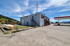
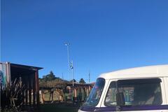
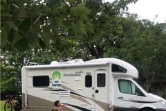
Gas station with propane and water tank fill. |
Henry's Lake Station | 44.62812, -111.33315 | |
|
||||
|
tom
|
Perfect spot for an overnight stop. The connector road between the Eastbound and Westbound rest areas is quite quiet and peaceful. |
Pine Grove Rest Area | 49.66081, -96.05450 | |
|
||||
|
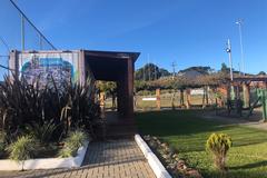
www.trailblazer.co.za
|
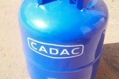
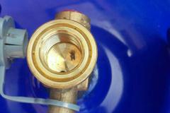
Drop off and collect your refilled cylinders here within 24 hours. One can only get refills done here through dropping and collecting here. Ramco will not accept refilling done directly at their refilling station as from date of this checkin:
|
Ramco Gas | 0.34754, 32.61708 | |
|
||||
|
stefan.postma
|
The place has many special vegan / veggie and biological food. If your on a special diet this is your place. The prices are not almost 2 higher times compared with chedraui. The have a nice wine selection and serveral artesenal beers. Further a fresh bakery with French quality bread but then again way more expensive than the regular supermarket. |
Gypsea Organic and Vegan Market | 20.20557, -87.47954 | |
|
kombiamora
|
um lindo lugar, com parque infantil, quadra de esportes e banheiro publico muito limpo. Tomamos banho quente nos banheiros. E ganhamos tomada para ligar a energia do Motorhome. a beautiful place, with playground, sports court and very clean public bathroom |
Praça Municipal Manoel Pinto de Arruda | -27.95365, -49.87472 | |
|
||||
|
kombiamora
|
posto sem comodidades, porém aceita cartão e fica bem no centro da cidade. station without amenities, but accepts card and is right in the city center. |
Posto Santana | -27.95367, -49.87468 | |
|
bru
|
Gray- Black water dump Station. Pass the Gas Station and next to the Staff car parking. Unfortunatly no sign and unmarked. |
Luzern-Neuenkirch | 47.11062, 8.23424 | |
|
||||
|
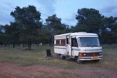
alan.vestal08
|
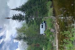
Very cool place to camp. Wide open looking out over the badlands. Plenty of places to camp. No water so camel up before you leave town. Oh, no bathrooms. Might have to get creative if you’re tenting. |
Buffalo Gap National Grassland | 43.88970, -102.22671 | |
|
diana.c.miller
|
Peaceful spot not far from Lared. Juan, the owner, is very kind and helpful. Big rigs with hookups $40, simple site $25. Clean bathrooms and mellow atmos. |
Vaquero Village RV Park | 27.79010, -99.45762 | |
|
milesmcbeam
|
Seemed like a decent place to stay until I was moved on by police at 4:15 in the morning. It could be that they're cracking down because of the virus, and my 51 year old multi-colored VW bus is anything but subtle, but I still wouldn't recommend. |
Lunada Bay | 33.77148, -118.42121 | |
|
kingn26
|
Superbe parc avec plage. Toilettes, douches et tables de pique-nique. Parking gratuit. Très fréquentés par beau temps. Accès via une route avec une pente de 19% |
showers at Plages-Jaques-Cartier | 46.75076, -71.31149 | |
|
kingn26
|
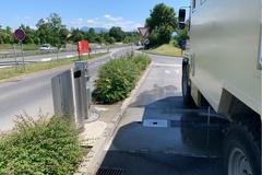
Vidange, eau potable et poubelle. Très propre. Au bout de la rue. |
Aire de vidage / Dump Station | 46.79154, -71.35013 | |
|
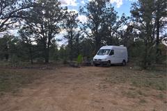
RVwithRandC
|
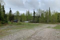
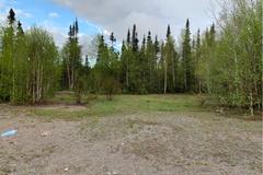
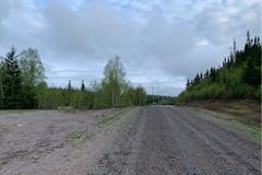
This is a good spot about a quarter mile off 385 on 342. We had no issue getting our 42' 5th wheel in the spot from either direction. It was a little wet and we did have to use 4WD while backing in. We also were able to fit a 38' Class C in the spot with us. We back all the way into the site and had to raise our jacks all the way up to get level. The Class C found a spot and only had to use a couple leveling blocks. There were a few cars passing by during the day. This spot is under the power lines and we had 1 bar of 4G LTE service with Verizon. The GPS coordinates are 43°35'45.3"N 103°30'42.7"W (43.595909, -103.511870). |
Great spot off 385! | 43.59591, -103.51187 | |
|
||||
|
dallwine3
|
Missed the turn that went directly through the field and decided to go around the back of the field which was a mistake. Road was very narrow and rough and would be treacherous for vehicles without 4WD. Eventually we found the patch of trees with a nice fire pit. There are plenty of cows around so watch out for patties. A few people drove by early in the night but after that it was nice and peaceful. Phone service was a plus too. |
Forest | 38.03887, -112.58055 | |
|
mksapp91
|
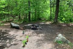
Two decent campsites right off the main road near the bridge. You can hear a little traffic and people do use the gun range(a dirt hill at the entrance). Heard well over 500 gunshots between 7am and noon. These spots are easy for a small rv to get into. If you drive further down the road there are a few tent/small vehicle options along the way and one decent spot for a group, small rv, our van just past the day use area. At the end of the road near the pond are several tent sites and a large site a van or group can fit in. Don’t try to go past the day use area to the end unless your rig is capable of handling rough roads and you are comfortable backing up in tight spaces for long distances. |
Elbow pond, New Hamshire | 43.99419, -71.75028 | |
|
||||
|
lamponroad
|
We stayed there 3 nights. We parked close to cafe dumonde in a parking lot with big space for our rv 24ft. It’s energy and it’s too much safe. We stayed closed to the rangers and the guys told us that everything ok overnight there. We really declined |
NOMA | 29.98500, -90.09234 | |
|
||||
|
lilya
|
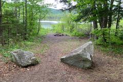
Great camp ground right by the River, you can also find it on Google maps. Nice and quiet, but at night lots of Coyotes. About 5 camp spaces along the river, some fire pits available. |
Coeur d'Alene River | 47.47988, -116.70064 | |
|
||||
|
steven
|
Peaceful and relaxing for 3 days. Will stop again |
Reservoir Rd Dispersed Camping | 37.73633, -79.27187 | |
|
||||
|
taliadoyle
|
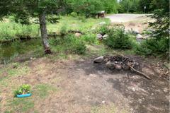
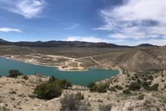
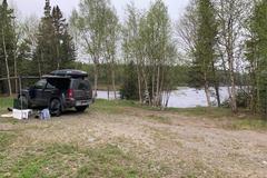
Campsites with firepits, covered picnic tables, grills, pit toilets. Beautiful blue water, with a boat launch - some algae along the shore that would’ve been gross to wade in, but there’s a little cove to the left of the boat launch that’s great for swimming. Bring your own firewood. Wind was so bad on our second day that we had to pack up, leave, and go to a hotel in Ely, as the other tent campers did. But we came back the next day for hiking and swimming. Even though there were plenty of other campers, we didn’t cross paths or even hear anyone else the entire time we were there. (Picture is of the campground from the top of the hill.) |
Illipah Reservoir Recreational Area | 39.33415, -115.39194 | |
|
||||
|
Martina
|
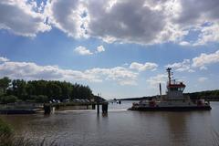
Nice free spot for up to 15 (depends on the size) RVs. No facilities. The ferry is for free! A WC is on the other site of the canal. Also a restaurant. The little and nice village Burg has a supermarket (Edeka) and an ice cafe.
|
Burg Nord-Ostseekanal at the ferry | 53.98185, 9.28034 | |
|
||||
|
Andrew90
|
Great site. Lots of room for any size vehicle, probably accessible by RV but I will let someone else evaluate that. Road to site is in excellent condition, some potholes and washboard but really excellent overall. Be bear aware. Some other sites along the road to this one, but I found this to be the best one. |
Cleave lake | 48.96785, -87.37856 | |
|
||||
|
Why Arent You Turning Left
|
A massive car park for the look out point. There are no no camping signs. The view is stunning. No services but good cell signal on PublicMobile. |
Chedabucta Bay Look Out Point | 45.34856, -61.41325 | |
|
davidrigal
|
I'm surprise this hasn't been mapped yet. Massive fields with pine trees open grass and both tarmac and off road tracks. There must be a 50 hectares of camping ground here. North side of the road from Podgorica to the Albanian border. If you come from Podgorica take a right after the deka fuel station (last one before going to Albania). Quiet at night, cars with lovers around but loads of space to find a private spot. Birds, good sunset, anywhere between 100m and 700m km from the main road. Open field, under the trees, whatever you like. Friendly people here in Montenegro, several locals told me it was fine for overnighting |
Big pine forest park | 42.41524, 19.28378 | |
|
||||
|
LoneWolfe
|
Nice and quiet campsite. A car with higher clearance would be ideal to get down the gravel roads but I was able to do it in my Honda Accord without bottoming out. Just drove very slowly. No cell service 15 minute drive up to Montezuma Pass |
"Base Camp" for Bear Spring | 31.37861, -110.33101 | |
|
||||
|
jbstee0193
|
Great spots on this road. Still felt secluded. The spot we were at was pull through and had sooo much human feces it was ridiculous. Please remember to bring a trowel to dig a cat hole 6in deep for human poop. Or pack it out. |
Kaibab National Forest 4 | 36.00550, -112.15014 | |
|
||||
|
r8yQqy6zELKsPFAdabwv
|
Overnight camping on the left side of the store. We went inside and asked and they said no problem. There were several other campers here as well.
|
Cabelas | 38.02583, -84.41035 | |
|
||||
|
vmelissad
|
Rest area beside the road surrounded by trees. Near a beautiful trail named the Crowsnest Pass Ridge. Picnic tables, outhouses toilets, no water. This rest area allows you to stay for 8h.
|
Crowness Pass Rest Area | 49.64977, -114.69962 | |
|
||||
|
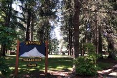
wot
|
County park & campground. Closed due to COVID when I drove by |
Tollbridge Park | 45.51856, -121.56778 | |
|
||||
|
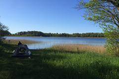
Heavy Bike Adventures
|
A nice place to stay overnight or have a picnic near Luoka lake. |
Lake Luoka camping | 56.00099, 21.95468 | |
|
||||
|
tmccann858
|
Was a fun drive up in my VW Jetta wagon. Deff would have been better in a Jeep. But doable. Previous statement said decent phone coverage, it’s mostly true. My friend had to work remote tho and she had a hard time getting enough coverage to send a few files. But if that’s not important than it’s such a great spot. Quite, remote, and private. Beautiful. |
Forest Service Dispersed Camping | 37.67182, -118.94530 | |