Check-Ins
| When? | Who? | Comment | Place | Location |
|---|---|---|---|---|
|
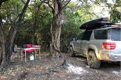
bucklanddj
|
Closed for the winter. |
Canadian Tire | 50.12208, -120.76190 | |
|
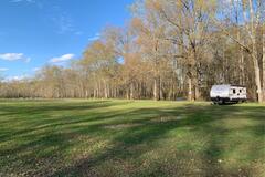
kgage65
|
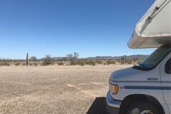
We loved it here! Plenty of spots further up but we stayed closer to the main road and still barely heard any passing cars. Next to the creek and gorgeous scenery! Level spot for an RV and easily accessible in 2wd! |
Little Hay Creek | 44.41386, -120.49594 | |
|
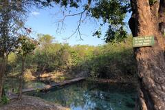
eric
|
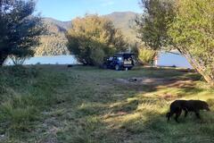
Great spot next to the lake vault toilet is open several campsites right in the lake |
cherryville nosho fishing and camping | 37.42412, -95.19754 | |
|
||||
|
catch-the-wind.com
|
Correct location is:
Rundown. Opened a room. Flat parking. Big rig friendly. |
Intercounty Gardens Hotel | -1.37662, 37.99782 | |
|
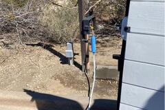
catch-the-wind.com
|
Drinking water. KSH 1 / L. Pipe from over fence. Go to shop to ask. |
Water Filling Station | -1.42942, 38.04793 | |
|
||||
|
eberhard.waehner
|
.... All what has been said before.
|
Fraaigelegen Farm Tulbagh | -33.36338, 19.20311 | |
|
hmedina.geonomad
|
Fantastic coffee, bakery and good restaurant. The egg, bacon & cheese sandwich is superb!!!! Must stop before or after Etosha! Spar next door and fuel stations. With good Agar parking. Perfect! |
Outjo bakery | -20.10651, 16.15145 | |
|
partirencombi
|
Big grass area, only some cows and birds !
|
Riverside | 26.45823, 90.90490 | |
|
||||
|
stephx0
|
Plenty of parking. 2WD van drove just fine through the area towards our parking spot for the night. Quiet area with beautiful views! |
Coconino National Forest | 34.81915, -111.90565 | |
|
matthias.grawe
|
We came here for a car repair.
|
Palmwag Lodge & Campsite (Gondwana Collection) | -19.88668, 13.93691 | |
|
ale.garciadelrio
|
Without option i camped here, there is a flat surface next to the road and a abandoned . There are some trees for shadow at the morning. Quiet at night. |
Roadside | -34.25984, -55.40221 | |
|
||||
|
joshuasteinberg91
|
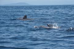
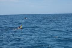
Here is the Pier wehere you can find a Boat to Take you to the Marine Reserve behind Wasini Island. Amazing Snorkeling and Many Dolphins. Tours in the Group Boats start around 09:00. (1500-2000KSH, extra 1000 for Lunch on Wasini Island) Individual Tours start any time (7000-8000 KSH per Boat) Snorkeling Gear included, Finns at request. Our Captain "Abedi" and His Assistent "Said" where really friendly, spoke good english, explained a Lot about the local Nature and where really good in spotting turtles and Dolphins. Captain Abedi: +254 728 34 7101 Entrance Fee Marine Reserve for Non Residents 15,- Dollar. Pay at the KWS Office in Front of the Pier. We are careful with Our Budget but this was definetly worth It! To make IT cheaper you can Share the boat with Other travellers, Captain Abedi Takes Up to 10 People per Boat. Softdrinks and Snorkeling Gear inclusive. the More people the cheaper It gets per Person. |
Kisite Mpunguti Marine Reserve | -4.64694, 39.37734 | |
|
||||
|
ricardo_olazo
|
Parking along the road between outside Rest Area and before pier. Very noisy when arrived but not bad overnight. Many campers, vans and cars too |
Skyway Bridge rest area. | 27.63393, -82.67695 | |
|
||||
|
MoStrong_Adventures
|
This is the parking lot for Crater Azul when turning off of the PET 12 and driving through fincas. The turn is not marked. Look for a tiendita almost directly North of this gps spot. It’s next to the dirt road where you’ll turn. There’s a ranch house behind the tiendita. At the house the family will charge you to drive through their fincas. We were quoted Q30pp to drive through the fincas to access Crater Azul, Q100 for access + camping (for 2 people), negotiable. The family is very friendly and will answer any questions you have about Crater Azul. You’ll drive through several livestock gates that you’ll have to unlatch and re-latch as you pass. The road is a bit rutted out but we saw a local van make it. High clearance will be helpful, but not necessary. It looks like it’ll get muddy when it rains. Not suitable for big rigs due to the low tree branches and a narrow, wooden plank bridge. We came in a 2.5m tall Toyota Sequoia. Flat, shaded parking spaces, trash cans, a pit toilet (just a hole in the ground) with plastic sheet walls on 3 sides. You can make a fire for grilling; there’s wood around. Crater Azul is actually a spring (not a crater) with crystal clear water. It’s very pretty and good for swimming. It looks more beautiful when it’s clean, but after busy days there can be lots of trash around. It can get overcrowded on weekends and holidays, as boats of people also come from Sayaxche. Mostly National tourists. Recommend visiting during the week. Bring everything you need, including insect repellent. Claro signal unreliable/spotty. |
Crater Azul | 16.64069, -90.36891 | |
|
||||
|
williejoubert
|
Off season so the site is not managed. Also no fee. We staying a few days before moving on. 14 day max stay allowed.
|
Evely Recreation Site at Okanagan Lake | 50.20710, -119.46746 | |
|
joe33305
|
The road I is too hilly for big rigs. My class C unit is 31’ and I didn’t chance it. Suggest boondocking next to Roadrunner in La Posa extended stay area for big rigs. Hardly anyone here when I camped here. Nice and quiet. |
BLM Road Runner | 33.58646, -114.21928 | |
|
||||
|
wasabi.mommi
|
Nice large pull off from the road with a fire ring. Near hiking trails. Had a large puddle full of toads when we visited in March. Easy to get to. I wouldn’t recommend taking your moms civic but you don’t need 4x4 |
Toad Pond | 34.65827, -84.11510 | |
|
xander_troy
|
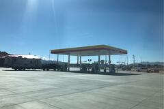
next to some of the pumps are water spigots. hooked up and filled no issues |
Shell Gas Station | 38.06489, -117.22718 | |
|
smidovi.wordpress.com
|
You have to enter by an destructed open gate. Locals are using this place for fishing and barbecue. You can stay just after the entrence or continue more far on the beach to the left and there is great grassy area. There is a house near by (summer house) empty at the time we were here. Strong wind started during night so we moved our car (with roof tent) to the forest, there is a road leading to the house. Locals uses this place, so rubbish arround. Entel internet signal. No big rigs because of entrance and tranches. Friendly dog all the time with us. |
Grassy-muddy beach | -37.92246, -71.59577 | |
|
||||
|
priscilla.r.brown
|
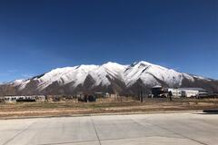
They have RV gas pump lanes, they also have propane. Clean bathrooms & mad snacks. Easy to get in and out. BOMB VIEWS. |
Holiday / Sinclair gas | 40.10006, -111.61135 | |
|
||||
|
brookebeyond.com
|
Had a little trouble finding water elsewhere in the 29 Palms/ J Tree area without going into the park and stopping at the ranger station— but there’s a standard threading spigot on the left side of the carpark when you drive in, and it screwed right onto our hose! Filled up our entire 40g tank for a long week of exploring. |
Oasis Visitor Center | 34.12889, -116.03721 | |
|
||||
|
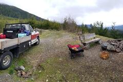
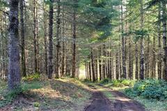
Shawn Hedges
|
Spent the evening of March 26, 2021 at this spot. Forest road off Harris Main was in great shape, but spur road to campsite is starting to get brushed in...spent some time with my axe clearing the more troublesome alder. Campsite itself was great...lots of space, great views, well drained, benches and fire ring. Lots of garbage and TP around though. |
Camping spot with view | 48.60357, -124.27709 | |
|
||||
|
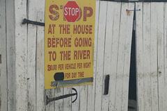
kitfield.vernon
|
BE WARNED! We, perhaps ignorantly, clicked the Google Maps option in iOverlander to get to this location and didn’t double check the directions. It took us to the wrong side of the river and down a road called Johnny’s Road. We passed one house with unwelcoming signs and then saw a huge sign stating we needed to pay $30 to camp at this location (photo attached). It appears on Google Maps as Johnny’s Camp and JR Campground but looked more like a private run thing. We didn’t feel comfortable checking in at a personal residence and didn’t feel as though $30 was worth it given the free spots near by. |
Down by the River | 38.77000, -78.39386 | |
|
||||
|
sierraindia87
|
I am pretty sure this place is free!
|
Stevenson City Park Campground | 34.85506, -85.83311 | |
|
||||
|
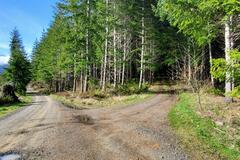
turboyacht
|
forest road dead end camp spot. keep right just off the main forest road, the road is up hill and 4x4 is recommended but no clearance issues. At the top is a dead end camp spot, level room for 2 rigs, it was very quiet forest camping. |
forest road dead end camp spot | 44.55428, -123.54003 | |
|
||||
|
xander_troy
|
water spigot by bathrooms. looks like hose will attach. |
Rest Area | 38.50595, -118.17865 | |
|
fliacoriale1237
|
Lugar limpio , ordenado y cuidado pero No es un lugar para parar en motorhome o casilla rodante , no brinda buen servicio , el agua para bañarse lo dan de solo de 19/21hs y si se acuerdan de prender la caldera te bañarás, sino No
|
Cabanas Chacra El Sentinela | -37.24198, -56.97210 | |
|
||||
|
terriannjma
|
Nice little spot for 21 foot Class B or a lot of tents. Was muddy after recent rain but ground very stable. Able to find level spot without too much difficulty. Exposed to the road, but road very very quiet! |
Green Ridge State Forest | 39.65688, -78.48351 | |
|
||||
|
kschultz1234
|
perfect place to watch the sunset then camp afterwards nearby in numerous dispersed campsites, all with firerings. spot is a scenic overlook overlooking skull valley to the right and wilhoit the the left.
|
Sunset viewpoint | 34.50466, -112.55574 | |
|
Am2021
|
Nothing there today, but could be because it's a Sunday. |
sanitary control for covid | -26.36316, -70.50481 | |